 |
 |
 |
|
|
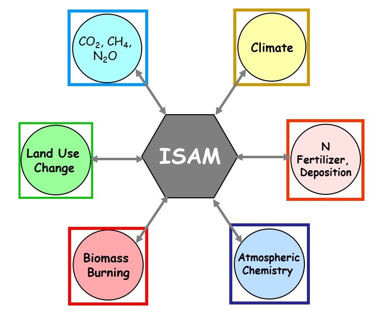
Data Sets Global Historical Land-Cover Change and Land-Use Conversions (Download)Discussed in the publication, Meiyappan and Jain (2012), Three distinct estimates of historical land-cover change and land-use conversions for over 200 years, Frontiers of Earth Science, 6(2), 122-139 (PDF). These datasets describe annual historical changes in land cover and underlying land-use conversions at 0.5x0.5 degree resolution. The datasets are currently available in NETCDF format. Three distinct estimates of land-cover change and land-use conversions were reconstructed using three different datasets on cropland and pastureland based on RF data (updated estimates based on Ramankutty and Foley, 1999), HYDE data (HYDE 3.1 'baseline' scenario - Klein Goldewijk et al. 2011) and HH data (Houghton 2008 - estimates based on FAO 2006). All the three estimates used common wood harvest and urban land data based on Hurtt et al. (2011) and Klein Goldewijk et al. (2010) respectively. The method of reconstruction utilized multiple years of MODIS land cover data (Friedl et al. 2010) as boundary conditions to implicitly account for unaccounted land-cover change. The land-cover maps produced for recent years are consistent with MODIS satellite estimates. The three estimates developed based on three agricultural datasets (HYDE, RF and HH) are referred to as ISAM-HYDE, ISAM-RF and ISAM-HH respectively.
ISAM-HYDE estimates cover the period 1770-2010 The annual land-cover maps contain the area (as percentage of grid cell area) of 28 land-cover types within each 0.5x0.5 degree grid cell. The annual land-use conversion maps contain the area transitioned (as percentage of grid cell area) for each of the 92 unique conversions possible. More detailed information on the format of data is provided in the README file. Selected Animations based on ISAM-HYDE EstimatesEach file is about 33MB in size
For any questions, contact: Prof. Atul K. Jain University of Illinois at Urbana-Champaign jain1@illinois.edu
|
|||||||||||